I really enjoy designing creative for Mendip Hills AONB, not only are they friends but we are really in tune with our beliefs in sustainable conservation. Jim Hardcastle originally briefed me on the idea to design some Top Trumps cards in June last year and in December we brought the project back to life. This meant we were able to add a documentary photography element to the project which was right up my street.
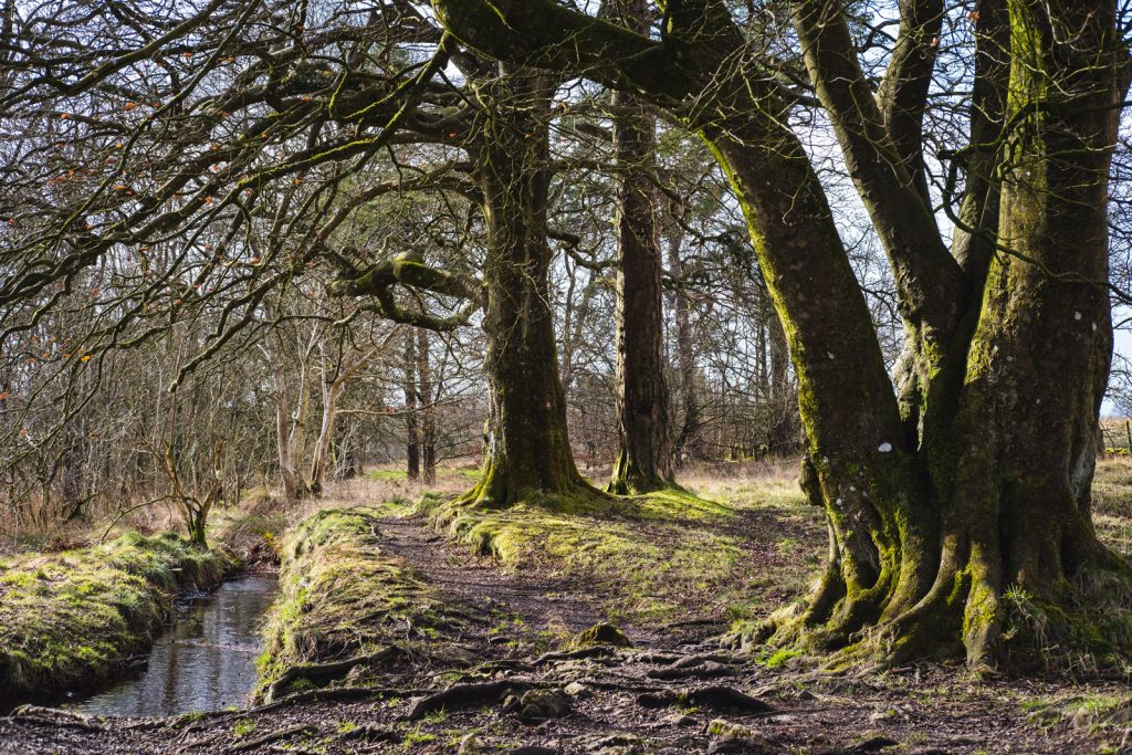
Whilst we got some other projects completed we were able to create a beautiful collection of landscape photographs of the entire Mendip Hills AONB before starting the design phase of this project. This was a dream job and I was so excited to get the commission. I would look longingly out of my bedroom window hoping to see snow on Crook Peak when I was young. There are areas on the Mendips that I’ve been going to for nearly 25 years – being asked to spend a few days photographing these places felt incredible.
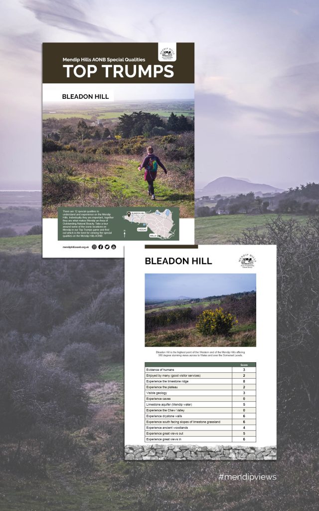
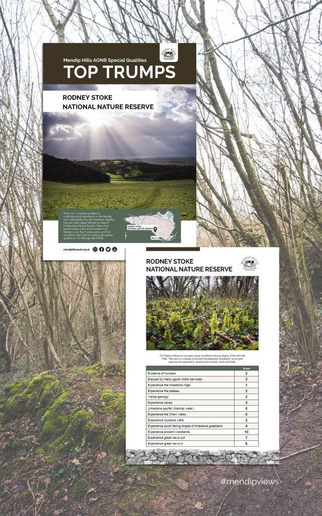
The brief was to create 18 A4 double sided Top Trump style cards that the Mendip Rangers could take to family events. The idea is to educate people about the benefits, geology, biodiversity and sustainability of each key location in the AONB.
The list of special locations in the Mendip Hills AONB that I photographed:
- Black Down
- Burrington Ham
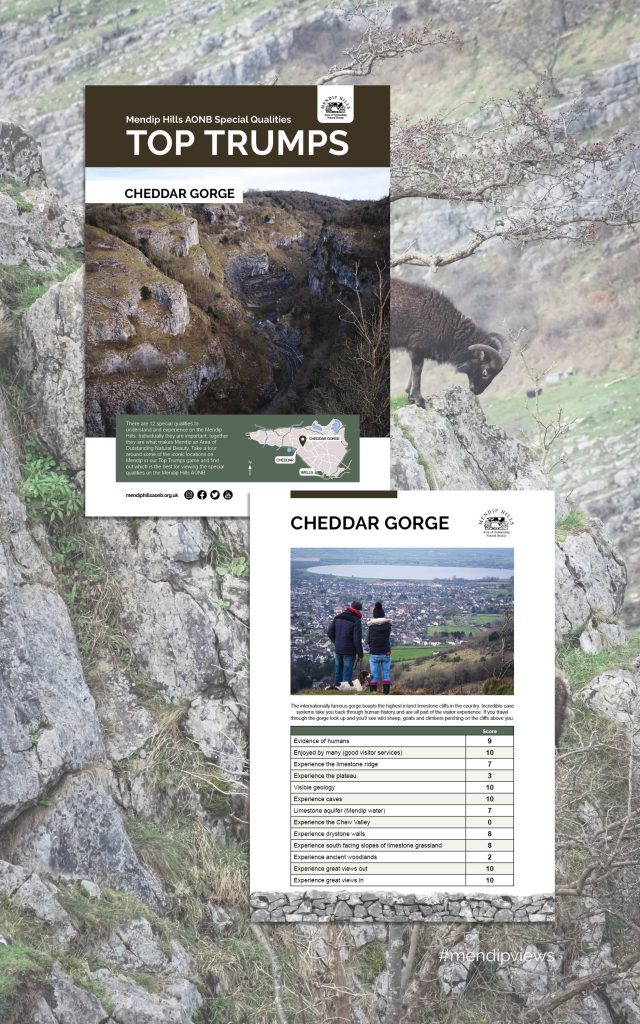
- Cheddar Gorge
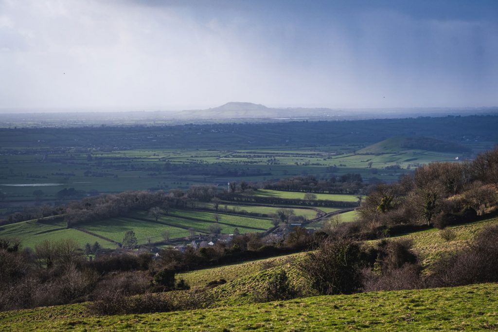
- Bleadon
- Dolebury Warren
- Velvet Bottom
- Wookey Hole Caves
- Priddy
- Priddy Mineries
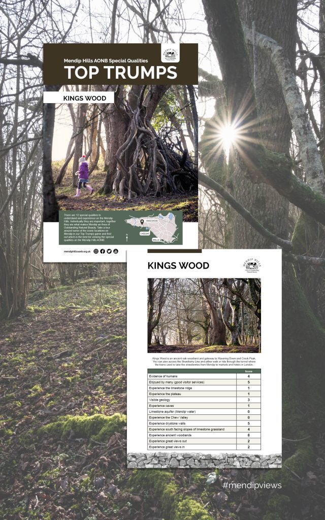
- Kings Wood
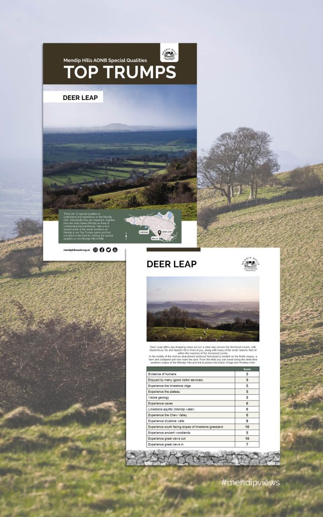
- Deer Leap
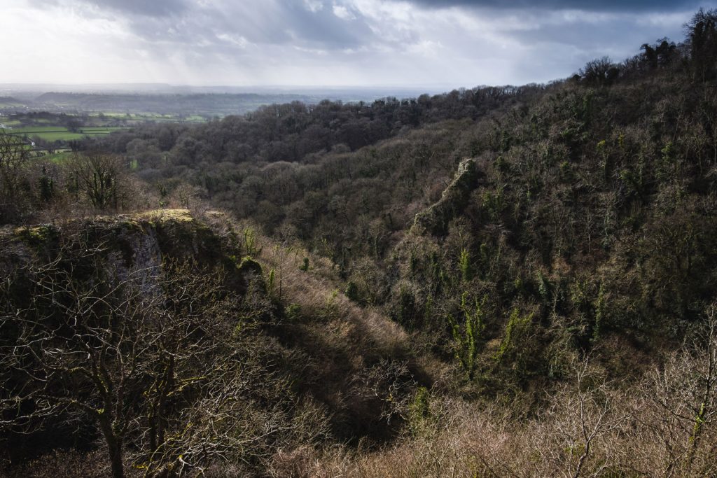
- Ebbor Gorge
- Chew Valley Lake
- Blagdon Lake
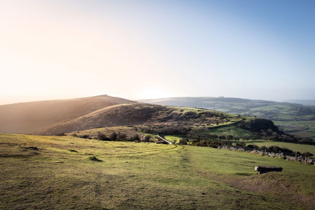
- Crook Peak
- Rodney Stoke Nature Reserve
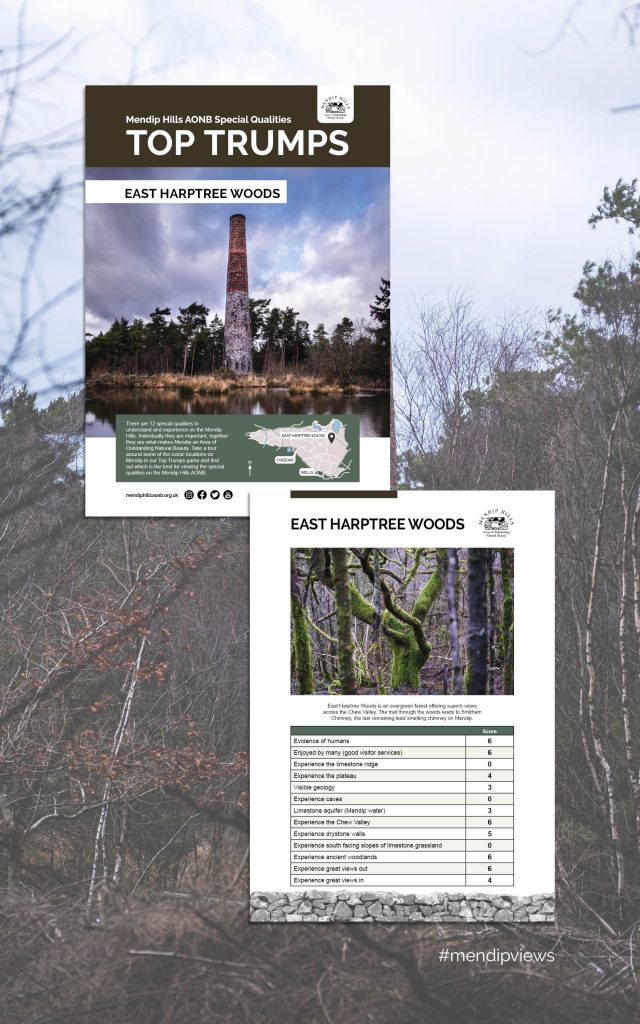
- East Harptree Woods
- Rowberrow Warren Forest
Mendip Hills AONB Landscape Documentary Photography
There were 19 locations to photograph over 3 or 4 days which meant that careful planning was very important. I didn’t want to be making too many trips back and forth and subsequently using lots of fuel, so I grouped the locations up and plotted walks/runs/bike rides between each one.
Day 1 – Bleadon & Crook Peak area
On the first day I parked at the lookout on Bleadon Hill and cycled down the track crossing over the motorway and winding through the lanes of Winscombe to Kings Wood. I then cycled up and over Wavering Down so that I could take some long shots of the iconic Crook Peak before descending a really good bridle path back to the road.
Day 2 – Cheddar Gorge and Black Down
This was the biggest day with nearly 35km of walking/running between locations carrying my camera gear in a Lowe Alpine Aizone Quest. I parked near Tynning’s Farm and ran down in to Cheddar then back up the South side of the Gorge, up Velvet Bottom, across to Black Down and Dolebury & Rowberrow Warrens. I had very changeable conditions that meant it didn’t look like I was taking lots of photographs all in one day.
Day 3 – Ebbor Gorge & Priddy
I had originally hoped to combine the two lakes into this day also but realised I just wouldn’t have had enough daylight to take good photographs. I parked at the stunning Dearleap and ran up to Priddy, up and over to Priddy Mineries then back down Monarch’s Way to Wookey Hole. Again, I had excellent conditions for outdoor photography combining a realistic mix of sleet, rain, sun and moody clouds. There was some beautiful light looking down from Deerleap but the clarity wasn’t quite as good as I had hoped.
Day 4 – Blagdon, Chew Valley and Deerleap take 2
On the final day of photographing the Mendip Hills AONB I drove to a few locations as this meant I was able to fill any missing gaps and make the most of the good light. I started at Blagdon Lake and spent some time proving why I am a useless wildlife photographer. I predominantly used a mix of the Fuji 55-200mm, 16mm f2.8 and 35mm f2 throughout this project but the chimney in East Harptree Woods suited the Samyang 12mm and my Cokin filters. As I was driving between locations, I could also afford to carry the extra weight of my Fuji 50-140mm f2.8 which is a very versatile and capable lens.
Moving on to the Graphic Design phase of the project
Now that we had a collection of photographs documenting the Mendip Hills landscape, I started laying out the copy and images in InDesign. We wanted the Top Trump cards to be aspirational but also very visual to really capture visitor’s attention. Sarah Catling, the Communications Officer for Mendip Hills, did an amazing job supplying the copy for the project and I joked that her briefs we a graphic designer’s dream.
I used the existing brand colours and visual identity along with a selection of illustrations that I have previously designed for other Mendip Hills projects. This ensured a consistent look that matched their website and other communications collateral.
With only a few revisions and tweaks, we quickly had a good master layout designed. This meant that I had a relatively easy job placing the copy and assets into each file and the using a script to batch process the Indd files to PDF with an artwork PDF preset.
We turned the project around in a couple of weeks and I delivered print ready artwork ready to go to Arien Signs in Cheddar. They are being printed and mounted on to recyclable Correx and I am really looking forward to seeing the result soon.
This was a wonderful project to be apart of and I’m so grateful for Jim and Sarah’s continued business. I love to create assets that encourages people to get outside and live more sustainably.