Tom Morris from Gawton Gravity Hub got in touch asking me to design some new clear trail maps. Gawton and Tavi Woodlands are the leading downhill parks in the south west and I know a lot of the riders from my time at Plymouth University.
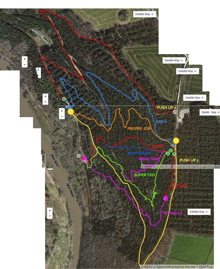
The first challenge with this project was to plot and extract the data from Strava and plot it in Photoshop, then export the paths in to Illustrator. I did this by using a number of GPS devices and surveying the tracks on foot then imported the data in to Google Earth.
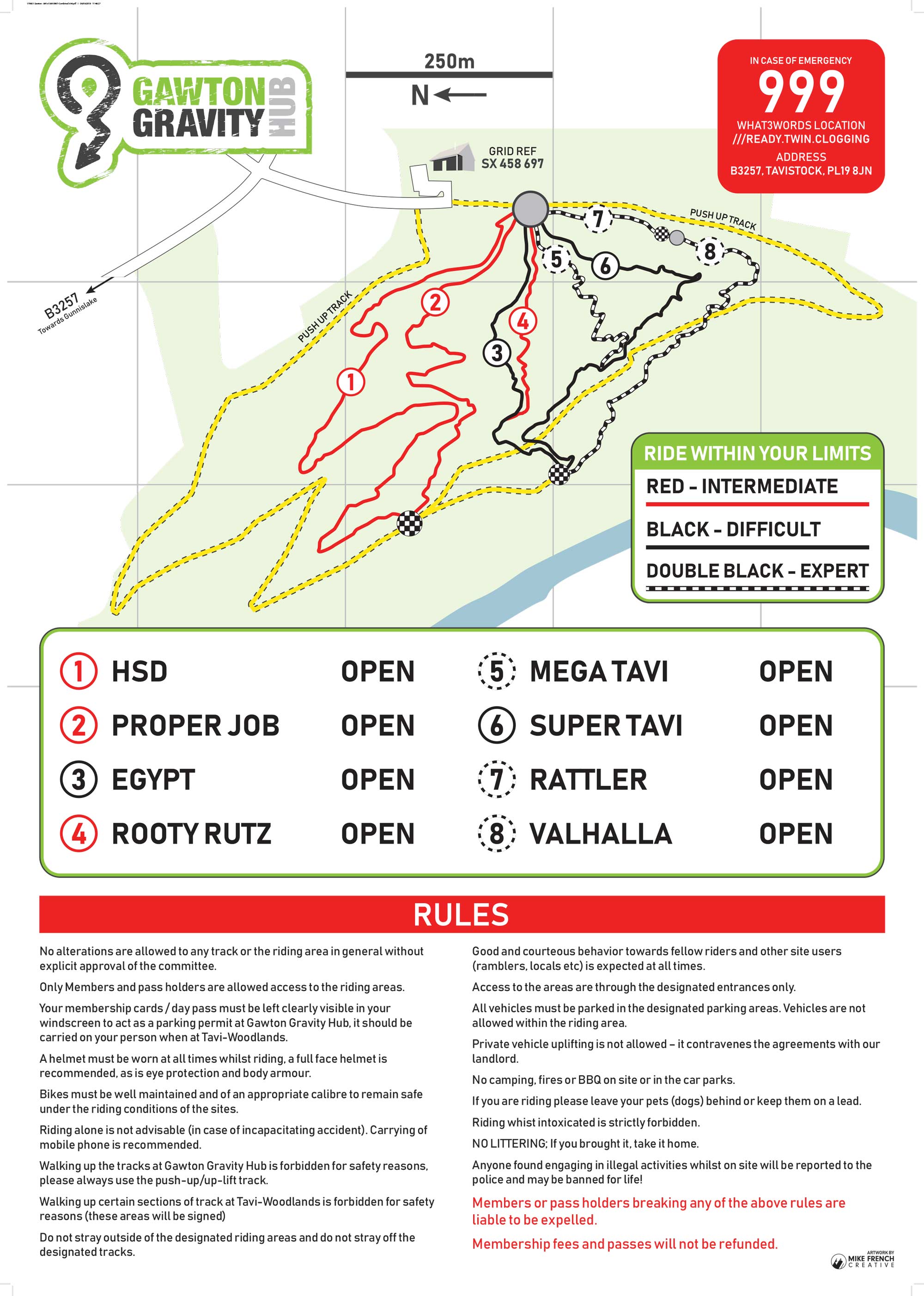
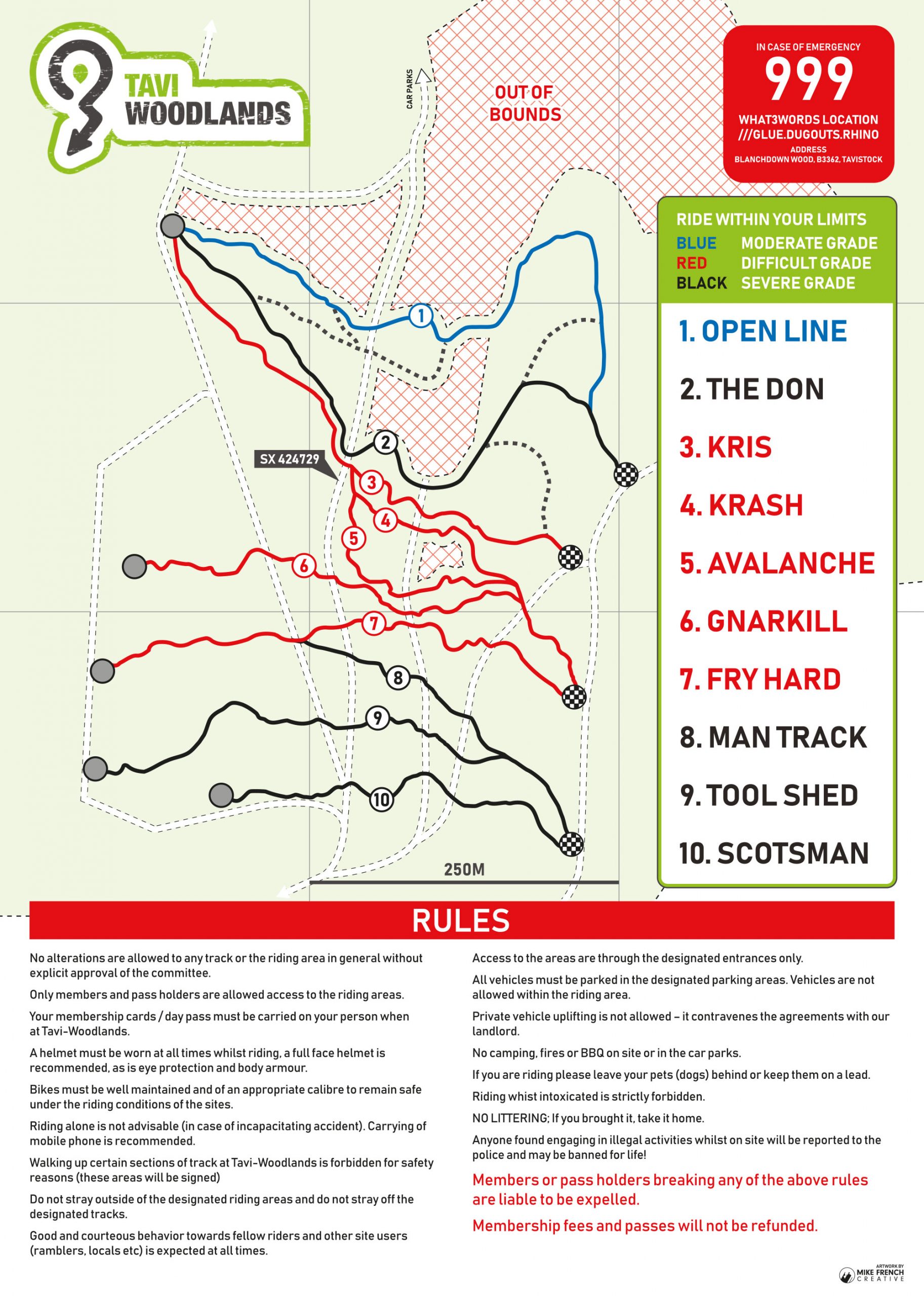
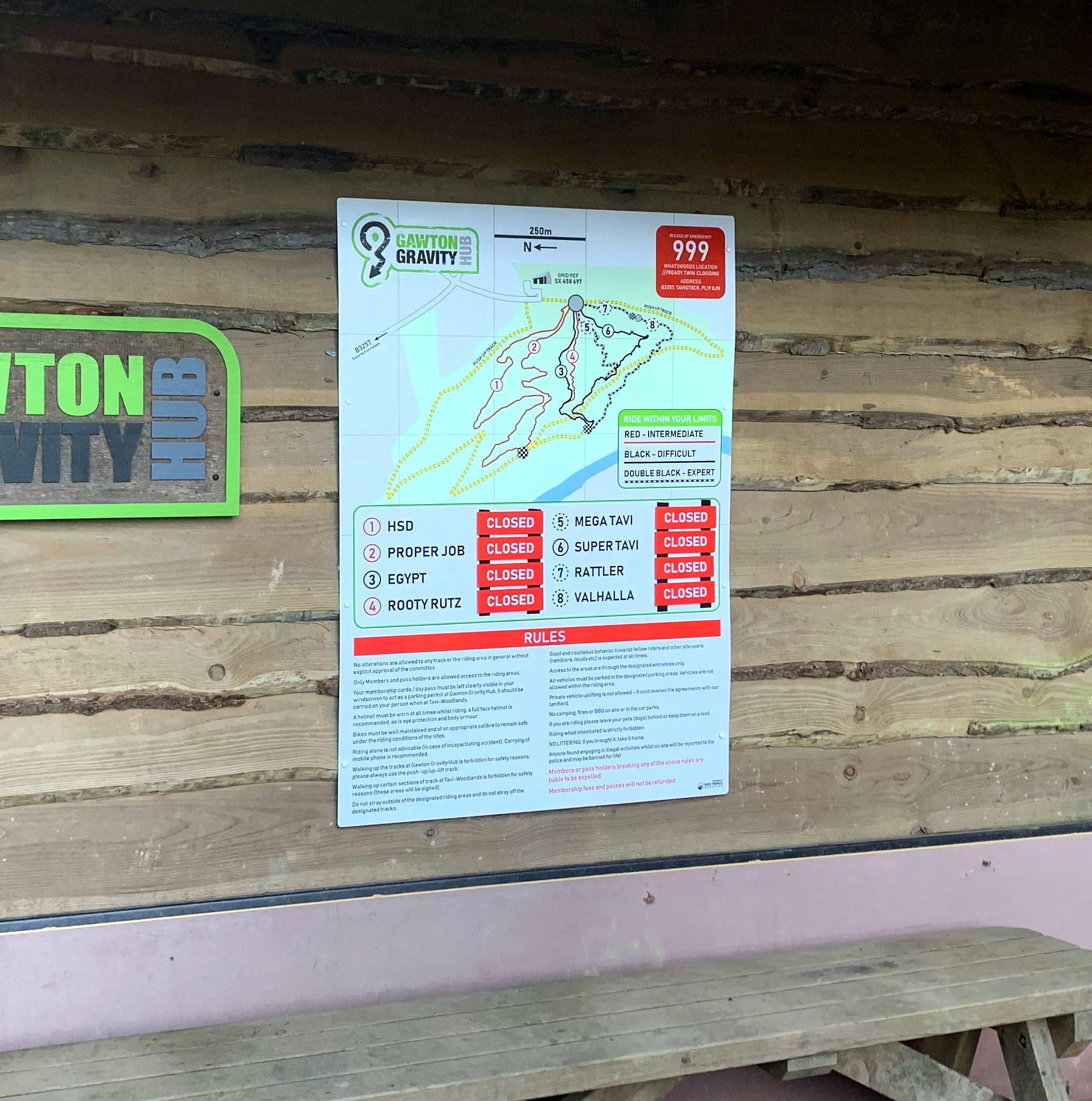
I then liaised with the signwriters to workout the best orientation and cost effective layout.
With input from the committee, we ended up with a pragmatic and functional piece of design that kept the Hub’s visual identity.